October 21, 2026
Saline Patches and Unresponsive Acres: When the Right Prescription Is Less Product
Variable rate is usually sold as putting more fertilizer where the ground is good. The half nobody advertises is taking product off the acres that cannot use it. On a central Alberta quarter with salinity and worn knolls, that is often where the money actually is.
What It Is
An unresponsive acre is ground where adding fertilizer does not add yield, because something other than nutrient supply is holding the crop back.
Two kinds show up constantly on central Alberta quarters. The first is salinity: the white crusted rings and bare patches around sloughs, in low draws, and along the toe of a slope, where groundwater carrying dissolved salts reaches the surface and evaporates, leaving the salt behind. The second is the severely eroded knoll: a hilltop where decades of tillage and wind have moved the topsoil downslope, exposing subsoil or carbonate, with the organic matter and the water holding capacity gone with it.
They look different and they have different causes, but they behave the same way in a fertilizer plan. On both, the limiting factor is not the nutrient. On a saline patch it is the salt concentration in the root zone, which makes water harder for the plant to take up even when the soil is wet. On a stripped knoll it is usually moisture, structure, and organic matter.
Put more product on either one and the yield does not move. On the saline patch, more product can make the problem slightly worse, because fertilizer salts add to a salt load that is already the thing limiting the crop.
So the right prescription on those acres is less. Sometimes none at all.
Who It's For
Growers who already believe in variable rate, or are considering it, and want the honest version of where the return comes from.
The pitch for variable rate is normally about the top end: find the high performing zones and feed them properly. That is real, and it works. But on a lot of central Alberta quarters the clearer and more defensible win is at the bottom end, because the unresponsive acres are easy to identify, they are stable year to year, and the product withheld from them is a direct cost avoided rather than a yield bet.
It applies to anyone farming:
- Quarters with slough rings, salt scald, or patches where foxtail barley and kochia dominate and the crop thins out
- Rolling parkland ground with knolls that have been farmed over for decades and now run a noticeably different colour than the midslope
- Fields where the same patches have shown up bare or thin in every aerial photo, every year, regardless of the season
- Operations already running prescription maps who have never put a zero rate zone in one
It applies less if your ground is genuinely uniform. Flat rate is the correct answer on a uniform field, and we say so in the variable rate article.
It is also worth reading alongside the management zone entry, because an unresponsive area is the cleanest example there is of a zone that deserves its own rate.
How It Works
First, separate the unresponsive acre from the merely hungry one, because they look identical from the air.
This is the single most important step, and the place most of the mistakes happen. A low vigour patch on a NDVI map tells you the crop is doing poorly there. It does not tell you why. A nitrogen deficient strip, a drowned out low spot, a compacted headland, a saline ring, and a worn knoll can all read as the same dull area on a vigour map.
The difference matters enormously, because the correct response is opposite. Feed the hungry one. Withhold from the unresponsive one. Get it backwards and you have either wasted product or starved good ground.
What separates them in practice:
- Walk it. Salt scald has a look: a whitish surface crust when dry, a dark greasy appearance when wet, a sharply defined bare edge rather than a gradual thinning, and a weed flora that gives it away. Foxtail barley, kochia, and salt tolerant species take over ground the crop has given up on. A worn knoll has its own look: lighter soil colour, visible carbonate, shallow topsoil when you dig, and crop that comes up but burns off early.
- Soil test the zone separately. This is the only way to know. A composite sample across the whole field averages the saline patch into the good ground and hides it. A sample taken inside the patch, submitted with electrical conductivity requested, tells you whether salinity is actually the problem and roughly how severe it is.
- Check the history. The defining property of an unresponsive acre is that it is always there. A wet spot moves with the season. A saline ring and a stripped knoll show up in the same place in every image of that field.
Second, understand why these zones are worth mapping once.
Most zone work is unsatisfying because the zones move. Vigour patterns shift with the weather, a wet year and a dry year can produce nearly inverted maps, and a prescription built off one season can be wrong the next.
Salinity and erosion do not behave that way. They are landscape features, not weather events. The salt discharge area sits where it sits because of how water moves through that landscape, and the knoll is worn because of where it is in the topography. Severity can vary with the water table across wet and dry cycles, and the boundary can breathe a little, but the core of the patch is where it was last year and where it will be next year.
That stability is what makes it economic. A zone layer you build once and keep using for years is worth far more than a prescription layer you rebuild every season.
Third, build the zone from more than one piece of evidence.
- Multispectral imagery across several seasons. One year is an observation. The same patch underperforming in a wet year, a dry year, and a normal year is a conclusion. Crop monitoring flights accumulate this on their own if the imagery is kept.
- Elevation. This is the piece people skip, and on salinity it is often the most informative. Salts arrive with water, so the discharge areas are a function of the landscape: toe slopes, closed depressions, and the ground below a recharge area. An RTK elevation model shows where water is going. The DSM versus DTM distinction matters here, because you want bare ground, which means flying when the field is bare. Field mapping covers both.
- Zone soil tests. The confirmation step. Vigour and elevation suggest, soil chemistry decides.
- Yield data, if you have it. Multiple years of yield maps are the most direct evidence of all, because they measure the outcome rather than a proxy.
Fourth, decide what the rate inside the zone should actually be.
There is no single answer, and anyone who gives you one without seeing the field is guessing. The decision ladder we see work:
- Severely saline, bare or near bare: zero or near zero. Nothing applied here produces a crop, and the fertilizer salt adds to the load. This ground is a cover and containment problem, not a fertility problem.
- Moderately saline, thin but producing: a meaningfully reduced rate matched to the yield the patch realistically makes, not the field average. The crop there is not going to make field average yield, so feeding it for field average yield is spending for a result that is not available.
- Severely eroded knoll: reduced, and the reduction is usually about moisture rather than salt. Low organic matter ground that dries out early cannot convert a full rate into yield in most years.
- Mildly affected ground at the edges: often close to normal. Do not over engineer the boundary. A zone map with four sensible zones that someone understands beats one with fourteen that nobody trusts.
A caution worth stating plainly: a zero rate zone is a decision to stop spending on that ground, not a decision to improve it. If the goal is to improve it, that is a different and longer conversation involving tolerant species, perennial cover on the worst of it, managing the recharge area uphill rather than the discharge area itself, and stopping tillage on the worn knolls. Those are the things that change the acre. A prescription map only stops you paying for it.
Fifth, flying it.
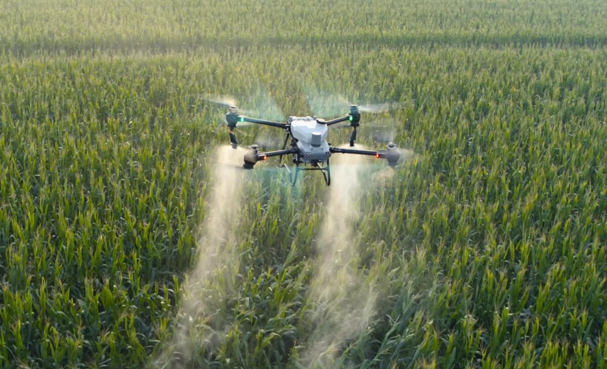
A drone granular pass follows a prescription the same way ground equipment does, with the rate changing by zone as the aircraft moves across the field. Two things about it suit this particular job:
- The zero rate zone is genuinely zero. The spreader shuts off over the patch rather than trailing product across it.
- The as applied map proves it. Every pass returns an as applied map showing where product actually landed and at what rate. For a zone strategy this is the part that makes it reviewable, because next season you can put the yield result beside the rate that was actually applied rather than the rate that was planned.
The prescription file handoff article covers getting your boundary and rate file to an operator in a form that works.
Sixth, the honest limits.
- The savings alone usually do not pay for the mapping. If a quarter has eight unresponsive acres, the product withheld from eight acres is a modest number. The case for mapping is built on the whole zone strategy across several fields and several years, plus the other uses of the same flight, not on the saline patch by itself. Anyone telling you the salt rings alone will pay for a mapping program is selling.
- It does not fix anything. Withholding product from a saline acre saves the product. The acre stays saline.
- Boundaries are fuzzy in reality. Salinity grades out rather than stopping at a line. A zone map draws a line anyway. That is acceptable, but it means the edges are approximate and should not be treated as survey grade.
- Severity moves with the water table. Across a run of wet years a saline area can expand, and across dry years it can contract. The core is stable. The margin is not. Revisit the layer every few years rather than treating it as permanent.
On the weeds, briefly. Foxtail barley and kochia colonising a salt patch is a real management problem and the question comes up every time. Granular fertilizer and seed spreading is the everyday legal drone service in Canada. For herbicide, Health Canada’s PMRA issued an interim Letter of No Objection in June 2026 that permits drone application of pesticides already registered for conventional aerial application, under those same label directions, where the registrant has not opted out, with Transport Canada and provincial applicator licensing still applying. It is a narrow, label bound, interim pathway rather than blanket approval, and products without aerial label directions are not covered. The current status article has the detail. It is also worth saying that herbicide is rarely the answer on a salt patch, because the salt tolerant species are there as a symptom rather than a cause.
Key Dates
- Best time to fly elevation work:Bare ground or short stubble: early spring or post harvest
- Confirming a zone is real:Same patch underperforming across a wet, a dry, and a normal year
- The decisive test:A soil sample taken inside the patch, with electrical conductivity requested
- Severely saline ground:Zero or near zero rate, and a cover decision rather than a fertility one
- Eroded knolls:Reduced rate, limited by moisture and organic matter rather than salt
- Rebuild the zone layer:Every few years, since severity moves with the water table
- Published cost figures:$10 to $15 per acre typical AB custom rate; about $4.50 per acre drone operating cost
How UAV AG Can Help
What UAV AG does on an unresponsive acre and zone building job:
- →Multispectral crop monitoring flights whose imagery is kept and compared season over season, which is what turns one observation into a defensible zone.
- →RTK elevation mapping flown on bare ground or short stubble, so the terrain model showing where water moves is measured rather than reconstructed under a canopy.
- →A delineated zone layer you own and reuse, rather than a one season prescription that expires.
- →Variable rate granular spreading that honours a true zero rate zone, with the spreader off over the patch instead of trailing product across it.
- →A georeferenced as applied record on every pass, so next year you can compare the yield to the rate actually applied rather than the rate intended.
- →A straight answer about whether your field is variable enough to justify any of this, including when flat rate is correct.
- →An honest accounting of what the savings are worth on your acres, rather than a number that assumes the salt rings pay for the program.
A Note From Us
The reason we wrote this one is that the variable rate conversation almost always starts at the wrong end.
Growers ask how much extra yield the good ground will make if it is fed properly, which is a fair question but a hard one to answer honestly, because the answer depends on the season. The question with a cleaner answer is the other one: how many acres on this quarter are you buying fertilizer for that cannot use it, and how confident are you that those acres are in the same place every year.
On a lot of central Alberta ground the answer to the second part is very confident. The salt ring around the slough and the worn knoll on the hilltop are not weather. They are the shape of the land and the way water moves through it, and they will be there next year.
The part we want to be clear about, because it would be easy to oversell: withholding fertilizer from a saline acre does not improve that acre. It stops you spending on it. Improving it is a longer and more interesting project involving tolerant species, perennial cover on the worst of it, and managing the water that recharges the discharge area, which is often uphill and in a different field than the problem. We are happy to be part of that conversation, but we are not going to pretend a prescription map is the solution to it.
What a prescription map does is stop the quiet, annual, invisible cost of fertilizing ground that was never going to pay it back. That is a smaller claim than the usual one, and it is one we can stand behind.
Frequently asked questions
What makes an acre unresponsive to fertilizer?
Something other than nutrient supply is limiting the crop, so adding nutrients cannot lift yield. On a saline patch the limit is the salt concentration in the root zone, which makes water harder for the plant to take up even when the soil is wet. On a severely eroded knoll the limit is usually moisture, structure, and organic matter that moved downslope decades ago. In both cases the fertilizer is not the missing ingredient, so buying more of it does not buy a crop.
How do I tell a saline patch from a nitrogen deficient area on an NDVI map?
You cannot, from the map alone, and that is the central problem. A vigour map tells you the crop is doing poorly in that spot, not why. A nitrogen deficient strip, a drowned low spot, a compacted headland, a saline ring, and a worn knoll can all read as the same dull area. The separation comes from walking it, soil testing the zone on its own with electrical conductivity requested, and checking whether the patch appears in the same place in every year of imagery.
Does fertilizer make salinity worse?
It does not help, and on severely saline ground it adds to the problem rather than easing it. Fertilizers are salts, and the thing already limiting the crop is the salt concentration in the root zone. The practical conclusion is not dramatic, since the amount involved is small against the salt the groundwater is delivering, but it does remove the last argument for applying a normal rate there. On the worst ground the right rate is zero or close to it.
Are saline patches stable from year to year?
The core is, and the margin is not. Salinity exists where groundwater carrying dissolved salts reaches the surface and evaporates, which is a function of how water moves through the landscape rather than of this season’s weather. The centre of the patch will be where it was last year. Across a run of wet years the affected area can expand, and across dry years it can contract, so revisit the zone layer every few years rather than treating it as permanent.
What rate should I use on a saline zone?
It depends on severity, and it is a judgement made with a soil test rather than from a map. Severely saline and bare ground takes zero or near zero, because nothing applied there produces a crop. Moderately saline ground that is thin but still producing takes a meaningfully reduced rate matched to the yield that patch actually makes, not the field average, since feeding it for field average yield is spending for a result that is not available on that ground.
Will withholding fertilizer fix the patch?
No, and it is important to be clear about that. Withholding product saves the product. The acre stays saline. Improving it is a different and longer project: seeding salt tolerant species, putting perennial cover on the worst of it, reducing tillage on the worn knolls, and managing the recharge area that feeds the water table, which is frequently uphill and sometimes in a different field than the symptom. A prescription map only stops you paying for the problem.
Do the savings justify paying for zone mapping?
Rarely on their own, and we would rather say so. If a quarter has eight unresponsive acres, the product withheld from eight acres is a modest number against the cost of a mapping program. The case is built on the whole zone strategy across several fields and several years, plus the other uses of the same flights such as elevation for drainage and in season crop monitoring. Anyone telling you the salt rings alone will pay for the program is selling.
Why does elevation data help with salinity?
Because salts arrive with water, so where salinity appears is largely determined by where water goes. An RTK elevation model shows the toe slopes, closed depressions, and low ground below a recharge area where groundwater is likely to discharge, which explains the pattern rather than just recording it. Fly it on bare ground or short stubble so the terrain model is measured, since a model flown under a standing canopy has to reconstruct the ground surface it never saw.
Can a drone actually apply a zero rate over part of a field?
Yes. The spreader shuts off over the zone rather than trailing product across it, and the aircraft keeps flying the pattern. The part that makes this worth having is the record: every pass returns a georeferenced as applied map showing where product actually landed and at what rate, so the zero zone is documented rather than assumed. That is what lets you compare next year’s yield against the rate genuinely applied.
How many zones should a field have?
Fewer than most software will encourage you to create. Four zones that you understand, can explain, and actually trust will outperform fourteen that nobody believes in, because a zone map only has value if the decisions get made from it. Salinity grades out rather than stopping at a line, so precision at the boundary is partly false anyway. Spend the effort on being right about which zones are unresponsive, not on the shape of the edges.
What about the foxtail barley and kochia on the salt patch?
Those species are there because the crop gave up on that ground, so they are a symptom more than a cause, and herbicide alone tends not to change the situation. On the drone question specifically, granular fertilizer and seed spreading is the everyday legal service in Canada. For pesticide, Health Canada’s PMRA issued an interim Letter of No Objection in June 2026 permitting drone application of products already registered for conventional aerial application, under those label directions, where the registrant has not opted out, with Transport Canada and provincial licensing still applying. It is narrow and label bound rather than blanket approval.