August 11, 2026
Variable-Rate Granular From an NDVI Map: What Is Real and What Is Hype
An imagery map is not a prescription. Here is the honest version of how NDVI turns into a variable-rate granular pass — where the technology genuinely earns its keep, and where a flat rate is still the right answer.
What It Is
Variable-rate application is sold as a straight line: fly the field, get an NDVI map, generate zones, spread more where the crop is weak. Every step in that line is real technology. The line itself is not quite honest.
NDVI is a vegetation index. It responds to how much green, actively photosynthesising leaf area is under the sensor. That makes it a good proxy for crop vigour and biomass — and a genuinely useful one, because it sees variation across a field faster and more completely than anyone walking it.
What it does not do is tell you *why* a zone is weak. Low NDVI in a patch can be nitrogen shortage, but it can equally be drowned-out low ground, salinity, compaction from a traffic pattern, a disease or insect pressure, a seeding miss, or simply a different soil type that was never going to yield the same. Those causes call for opposite decisions. Fertilizing a saline knoll harder because it looks weak is money spent making nothing happen.
So the chain from imagery to prescription is real, but it has a mandatory step in the middle that the sales version skips: finding out what the map is actually showing you.
Who It's For
Central Alberta grain and oilseed growers who have been pitched variable-rate, are interested in the idea, and want to know whether it will pay on their fields before committing to it.
It is also for growers already collecting imagery who have not yet turned it into an application decision, and who want to know what else they need before it is safe to.
How It Works
Here is the chain, step by step, with what each step can honestly support.
- Imagery — solid. A drone flight produces a high-resolution, current NDVI map of the field. This part genuinely works, and the resolution and timeliness are real advantages over waiting on a satellite pass that may be clouded out.
- Zones — solid, with a caveat. Zoning software divides the field into management zones from that imagery. The maths is sound. The caveat is that zones drawn from a single date reflect the crop's condition *that day*, which may be a temporary stress rather than a stable feature of the field. Zones built from several years of imagery and yield data are far more durable than zones built from one flight.
- Diagnosis — this is the step that gets skipped. Someone has to determine why the weak zones are weak. That means soil tests taken by zone, scouting boots on the ground in each zone, and the field history you already carry in your head — where the salinity is, where the old yard site was, which corner never drains. Without this step you have a picture of variation, not a reason for it.
- Prescription — only as good as step 3. Now a rate can be assigned to each zone, and the agronomics of that decision belong to your agronomist. Note that the right answer is not always "more where it is weak." On a zone that is weak because of a limitation fertiliser cannot fix, the correct prescription is often *less*, so the money goes where it can still produce a response.
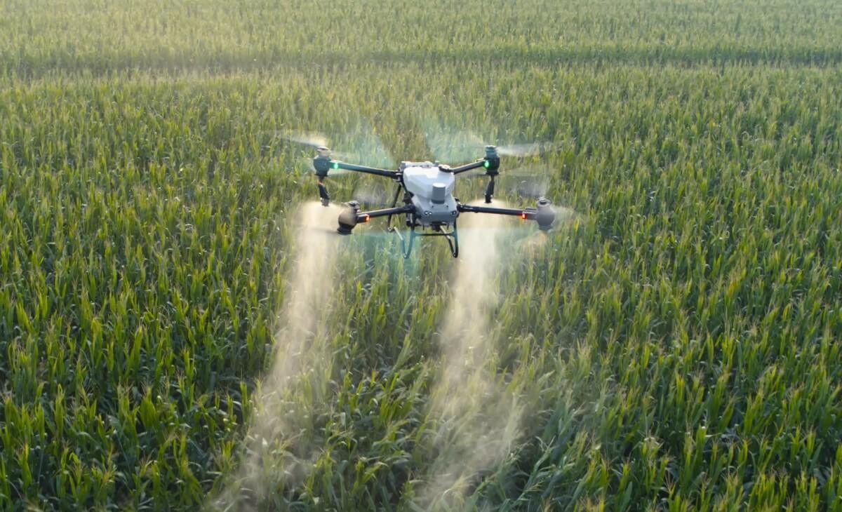
- Execution — solid. This is our part. A drone flies the prescription and changes rate by zone as it goes. The aircraft does not care about field shape, wet spots or point rows, and it puts no wheels on the ground.
- As-applied record — solid, and underrated. The pass produces a georeferenced record of where product actually landed, at what rate. That is what closes the loop: next season you can compare intended rate, applied rate and actual yield, and find out whether the prescription was right. Without it, variable-rate is an article of faith.
When a flat rate is the better decision. On a uniform field with consistent soil type and no history of distinct problem areas, variable-rate has very little variation to exploit, and the cost of imagery, zoning and agronomy will not be recovered. A flat rate, applied evenly and accurately, is the correct answer — and an even, calibrated flat-rate pass is worth more than a poorly executed variable one.
Key Dates
- What NDVI measures:Crop vigour and biomass — not nutrient requirement
- Mandatory middle step:Zone soil tests and scouting to find out why a zone is weak
- Best zone data:Several seasons of imagery and yield, not a single flight
- Closing the loop:The as-applied record checked against yield the following season
- Cost reference:$10–15/ac typical AB custom rate; ~$4.50/ac drone operating cost
How UAV AG Can Help
Where UAV AG fits in that chain — and where we do not:
- →We fly the imagery and we fly the prescription. Rate changes by zone through the pass, on any field shape, with no wheels on the ground.
- →We calibrate and pan-test for the product being spread, because a variable-rate prescription executed with an uneven pattern is worse than a flat rate done properly.
- →We hand back a georeferenced as-applied map so the prescription can be checked against yield rather than taken on faith.
- →We do not write the agronomic prescription. That belongs to your agronomist, working from zone soil tests and scouting — and we will say so rather than sell you a rate we are not qualified to set.
A Note From Us
The honest summary is that variable-rate granular is real, and the imagery step is the easiest and least valuable part of it.
The value is in the diagnosis — knowing why a zone underperforms — and that comes from soil tests, scouting and your own history with the field. An NDVI map without that is a very sharp picture of a question nobody has answered yet.
If a vendor offers to turn a single flight into a prescription without ever asking about your soil tests, your salinity or your drainage, that is the point to be skeptical. And if your fields are genuinely uniform, the most profitable advice we can give you is to skip variable-rate entirely and spend the money on an even flat-rate pass.
Frequently asked questions
Does NDVI tell me how much fertilizer to apply?
No. NDVI responds to green, actively photosynthesising leaf area, which makes it a good proxy for crop vigour and biomass — but it cannot distinguish a nitrogen shortage from salinity, compaction, poor drainage, disease or a seeding miss. Those causes call for opposite decisions, so an NDVI map has to be diagnosed with zone soil tests and scouting before it can support a rate.
Is variable-rate granular application worth it on my farm?
It depends on how variable your fields actually are. On a field with distinct, repeatable zones — different soil types, known problem areas, consistent yield patterns — there is real variation to exploit and variable-rate can pay. On a uniform field there is little to exploit, and the cost of imagery, zoning and agronomy will not be recovered. In that case an accurate flat-rate pass is the better decision.
Should I always apply more fertilizer where the crop looks weak?
No, and this is the most common mistake. If a zone is weak because of something fertilizer cannot fix — salinity, compaction, drainage — then applying more there spends money for no response. In those cases the correct prescription is often to apply less in that zone and redirect the product to zones that can still respond.
How many years of data do I need before zones are reliable?
Zones drawn from a single flight reflect the crop's condition on that one day, which may be a temporary stress rather than a stable feature of the field. Zones built from several seasons of imagery combined with yield data are considerably more durable. If you are starting from one flight, treat the zones as a hypothesis to be ground-truthed, not a prescription.
Does UAV AG write the prescription?
No. We fly the imagery, we fly the prescription and we document the pass. The agronomic decision — what rate belongs in each zone — belongs to your agronomist working from zone soil tests and scouting. We would rather tell you that than sell you a rate we are not qualified to set.
What is an as-applied map and why does it matter here?
It is the georeferenced record of where product actually landed and at what rate, generated during the pass. It matters because it is the only way to check whether a prescription worked: next season you can compare intended rate, applied rate and actual yield. Without it, variable-rate is taken on faith.